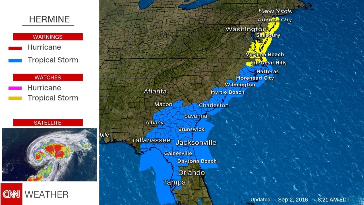
Hours after Hurricane Hermine made landfall in Florida, the weakened storm is working its way up the East Coast.
Here’s a quick look at the numbers behind the storm and what to expect going into Labor Day weekend.
The numbers
1:50 a.m. — The time Hermine made landfall as a Category 1 hurricane in the Big Bend area of Florida’s Gulf Coast.
11 — Years it had been since a hurricane made landfall in Florida.
1 — Person killed. A homeless man died during the storm after a tree struck him, Florida Gov. Rick Scott said.
40 million — People under tropical storm watches or warnings, which stretch all the way up to Rhode Island.
13 million — People under flash flood watches.
298,623 — Businesses and homes without power in Florida
The next 24 hours
The biggest threats Friday are flash flooding from the heavy rainfall in Georgia, South Carolina and North Carolina.
Tornadoes are possible throughout the day.
Hermine will reemerge in the Atlantic Ocean on Saturday morning near the Outer Banks of North Carolina.
What’s in store Labor Day weekend
Most models show Hermine lingering off the northeast coast, being blocked by a large area of high pressure to the north.
The storm should strengthen thanks to warm ocean water, but it’s not going to become a hurricane again. Instead it likely will be a post-tropical storm, the type of storm Superstorm Sandy was at landfall. Still, sustained winds could return to hurricane-force speeds.
The result will be strong on-shore winds stretching from the Outer Banks to New York’s Long Island through the holiday weekend, resulting in rough seas, rip currents and beach erosion, but not a lot of rain.


