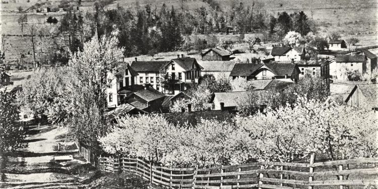
Utahville, in Beccaria Township, was once known as Mount Pleasant. It is one of the oldest Clearfield County settlements and appears on the 1818 county map that was drawn by Charles Trcziyulny.
The late Betty Welker’s 1983, 200 Years in Clearfield County historical and genealogical work recounted the story of Captain Edward Ricketts, whose family settled in the Mount Pleasant/Utahville vicinity in 1814.
Captain Ricketts was a French and Indian War as well as an American Revolutionary War veteran who accepted a Pennsylvania land grant as payment for his wartime service.
His lands were situated along the lower level ground of Clearfield Creek, between Madera and Glen Hope. Captain Ricketts died in 1813.
The next year, his son Isaac, heard frightening rumors of Native Indian attacks, which were goaded by the British during the War of 1812.
Ricketts, cautiously seeking protection, moved his family to the high ground of Mount Pleasant. The area today has, perhaps, hundreds of residents who are descended from the original Ricketts family.
Mount Pleasant added a hotel, o post office, a few small businesses and two churches as the community grew. One church, the Utahville United Methodist, is an active congregation to this day. Outlying farms surrounded the village.
In the early to mid-19th century, it was found that Mount Pleasant was an all too common name for a community, so Beccaria Township’s original village became known as Utahville.
A local fellow named Smith visited the Utah Territory. Upon his return, the village just became known as Utahville, and that was that. The local Pennsylvania dialect accented the first syllable and that pronunciation still holds today.
The Bellwood Branch of the Pennsylvania Railroad eventually made its way to Utahville from nearby Blandburg and Glasgow. The railway line provided a means of hauling coal from the mines, which opened in and around Utahville and Coalport.
Utahville is today a small residential community. The businesses are mostly gone and the Beccaria Township Building is located where the hotel and school once stood. Two roads, near its intersection, lead to Coalport.
The photo shows Utahville in the early years of the 20th century. It appears to have been taken from the hill that still leads to the Methodist Church and the cemetery that dates to 1840.


