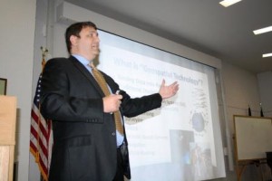
DUBOIS – Brendan Wesdock, an expert in geospatial technology and mapping systems, such as global positioning systems (GPS), offered a comprehensive look at the technology and its global influence during the annual Umbaugh Lecture at Penn State DuBois on April 18. Wesdock’s lecture, “There’s a Map for That: The History and Influence of Geospatial Technologies in our Everyday Lives”, delved deep into the history of mapping, illustrated the ways in which modern GPS and satellite systems were developed, and provided insight on how geospatial technology will further develop in the future. He pointed to items that people use every day, such as smartphones and Facebook, which were influenced by geospatial technology.
Wesdock is a senior associate and the director of military solutions with GeoDecisions, a division of Gannett Fleming, which specializes in information technology and geographic information systems. He is the program manager for GeoDecisions’ IRRIS program, which supports transportation security and logistics for the U.S. Department of Defense.
Before launching his career, Wesdock grew up in DuBois and Clearfield. He attended Penn State DuBois, and majored in geography.
Just as Wesdock’s career in geography evolved into working in geospatial disciplines using satellite systems, he explained to his audience that the first basic maps led to the eventual development of today’s highly advanced GPS systems.
“It all started with land surveying,” Wesdock said. “People have had maps for centuries, but they weren’t the intelligent maps we have now.” He explained that government initiatives in the United States spurred the development of maps that included more information. It began with U.S. Geological Survey topographical mapping, and spread to the use of aerial photography. Eventually, Wesdock said, what began as hand drawn maps evolved into technologically advanced systems like Google Earth, which can locate specific locations around the globe with satellites, and show users an actual photo of that location. He further explained, “Technology has come such a long way, that smartphones with GPS are accurate enough to locate people, not just in an individual house, but even pin-point what room of the house they’re in.”
Wesdock went on to describe how such technology is used in other significant areas, such as road construction, management of the earth’s forests and other vegetation, and more. IRRIS, the program that he managers, uses the technology to map out safe routes for the transport of military arms, ammunition, and supplies, and to provide real-time weather and traffic updates to the transport teams.
The lecture was free and open to the public. The Umbaugh Lecture at Penn State DuBois is made possible each year by the generosity of Robert and Joyce Umbaugh. Lecture organizer and campus mathematics instructor John Tolle said, “Robert and Joyce Umbaugh established this lectureship to bring knowledgeable speakers in the fields of science and technology to the campus each year. We are very thankful to them for supporting the campus in this very important way.”


