New Washington is another of Clearfield County’s boroughs that covers a sizeable amount of land area but has always had a small population. It is located in the southwestern part of the county, adjacent to Chest and Burnside Townships.
It was settled by James Gallaher, a Revolutionary War veteran years before it was incorporated as a borough in 1859. It was named Washington, in honor of Crawford Gallaher’s young son’s first name, and New denoted that it was a new town.
Typically, farming, lumbering and the small businesses that serviced those occupations formed the small mid-19th century business model of New Washington.
Churches, schools and homesteads grew along with the pre-industrial and low-tech economy of the time. The Odd Fellows (I.O.O.F.) was the town’s social and fraternal organization.
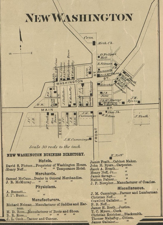
The map shown is part of the 1866 Pomeroy Company Map of Clearfield County. It is the earliest comprehensive map of the county.
New Washington looks to be doing well in the year following the end of the Civil War. Merchants, doctors and various craftsmen were likely busy at their trades.
Lumber and leather supplied materials for the carpenters, tanners and shoemakers. Local hemlock bark provided the tannic acid for leather-making.
Horse-drawn coaches were made in New Washington and the town had two hotels, most likely to accommodate traveling businessmen engaged in the logging industry.
They probably had to go the Washington House for a beer, or something stronger, as the Temperance Hotel sounds like it was a dry establishment.
For those having family roots in the New Washington area, the names of residents shown on the map may hold some important clues to your own line of genealogy.
